
You may well know that the Scandinavian Peninsula is a geographic term that refers to a landmass in northern Europe.
But do you know how many countries are in the Scandinavian peninsula? And what is the difference between Scandinavia and the Scandinavian peninsula?
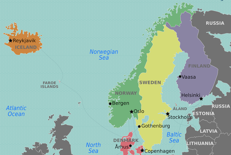
Where is the Scandinavian peninsula?
If you look at the Scandinavian peninsula on a world map, it is the chubby two-pronged finger of land that juts out from the northwestern corner of the world’s largest country, Russia. It is surrounded by the Barents Sea in the north and the Baltic Sea in the east.
To the west it is bordered by the North Sea and the Norwegian Sea, both part of the Atlantic Ocean.
To the east, it is separated from the south of Finland by the Gulf of Bothnia and to the south it’s divided from Denmark by the Skaggerak and Kattegat straits.
Which two countries occupy the Scandinavian peninsula?
Norway and Sweden are the two main countries in the Scandinavian peninsula, although geographically it also includes the northwestern corner of Finland.
Is Denmark part of the Scandinavian peninsula?
The simple answer is no – Denmark is not part of the Scandinavian peninsula. The question is often asked because of the confusion that arises about which countries are in Scandinavia and which are on the Scandinavian peninsula.
The Scandinavian peninsula is the geographical area that includes Norway, Sweden and a small part of Finland, while Scandinavia includes Denmark, Norway, Sweden, the whole of Finland, and sometimes even Iceland too.
For more on the complicated issue of which countries are in Scandinavia, which are on the Scandinavian peninsula and which are Nordic countries, read our Quick Guide to the Scandinavian Countries.
Why is the Scandinavian peninsula so important?
If you look at the Scandinavian peninsula map, you can see that geographically it adjoins Russia, although culturally and historically it is closer to western Europe.
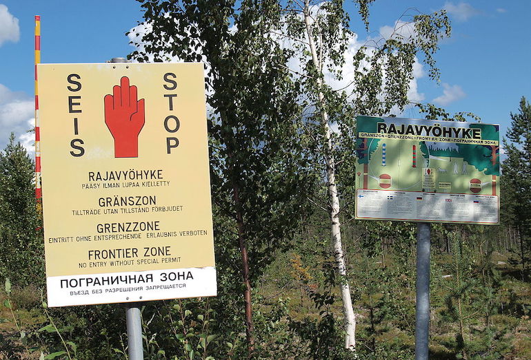
Lying between the Scandinavian peninsula and Russia, Finland is a member of the EU, though not Nato, and is aligned closely with the west despite its 1340 kilometre-long border with Russia to the east.
Another reason why the Scandinavian peninsula is of importance is that large petrol and gas deposits lie off the western coast of Norway, which play a large part in the wealth of the Scandinavian countries.
What is the geography of the Scandinavian peninsula?
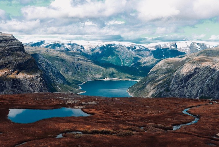
The Scandinavian peninsula geography essentially consists of a semi-mountainous mass, much of which is part of the ancient Baltic Shield.
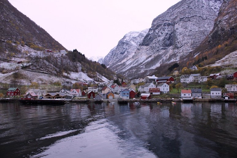
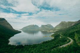
Its western coastline is indented with deep inlets known as the Norwegian fjords, which are backed by high mountainous terrain, while the eastern side of the peninsula is lower and flatter. Much of the east is forested, and there are many lakes, formed when the glaciers melted at the end of the Ice Age.
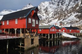
Both the east and west coasts of the peninsula are characterised by their many archipelagos – in fact, Norway, Sweden and Finland are the top three countries in the world for the number of islands.
What is the climate of the Scandinavian peninsula like?
The Scandinavian peninsula climate is perhaps not as cold as you might expect given its location. Since the peninsula stretches from the Baltic Sea in the south to well inside the Arctic Circle in the north, its climate is varied.
Unsurprisingly, in the north the climate is mostly tundra and subarctic, where inland areas reach the lowest temperatures, with regular falls of snow and ice in winter.
The south and west coasts meanwhile are warmed by the Gulf Stream and have a cool marine west coast climate.
Southern and central regions have a humid continental climate, meaning that temperatures can reach over 20ºC in summer.
What is the Scandinavian peninsula’s latitude and longitude?
The Scandinavian peninsula runs from between around 55º North latitude up to 71º North, with the Arctic Circle about two thirds of the way up at 66.6 North.
The longitude of the Scandinavian peninsula is between around 5º and 27º East.
What are the 10 Scandinavian peninsula and Baltic Sea countries?
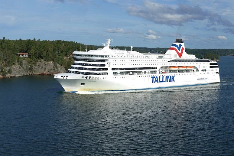
To the west and south of the Scandinavian peninsula is the Baltic Sea, which is an important strategic marine route for Russia and the other countries that surround this sea.
Nine countries have direct access to the Baltic Sea – these are Sweden, Finland, Russia, Estonia, Latvia, Lithuania, Poland, Germany and Denmark.
The tenth country is Norway which is connected to the Baltic via the Skagerrak and Kattegat straits.
Some of these countries – Denmark, Norway, Sweden, Finland, Estonia, Latvia, Lithuania plus Iceland – are members of the Nordic-Baltic Eight, a group of countries which co-operate on regional and international issues and promote relations between the Scandinavian peninsula and Baltic Sea countries.
Top ten Scandinavian peninsula facts
You think you know all about the Scandinavian peninsula? Well, here are some surprising Scandinavian peninsula facts:
- The Scandinavian peninsula is Europe’s largest peninsula, covering some 750,000 square kilometres.
- About a quarter of the Scandinavian peninsula lies within the Arctic Circle.
- The Scandinavian peninsula Vikings lived in the region from the ninth century to the eleventh century.
- Humans were first recorded living in the south of the Scandinavian peninsula some 12,000 year ago.
- The Scandinavian peninsula countries – Norway, Sweden and Finland – all have the more islands than any other country in the world.
- Lapland covers the northern parts of Norway, Sweden and Finland on the Scandinavian peninsula, and is where the indigenous, semi-nomadic Sami people live.
- The Scandinavian peninsula is home to mainland Europe’s largest glacier, the Jostedalsbreen in Norway.
- When measured by GDP per capita, the Scandinavian peninsula countries are among the wealthiest in Europe.
- The Scandinavian peninsula vegetation is largely Alpine with coniferous forests of native pine and spruce.
- Norway, Sweden and Finland, on the Scandinavia peninsula, regularly rank among the world’s top ten happiest countries.
See also:
All you need to know about Scandinavia’s flags
The best places to visit in Scandinavia
12 of the best places to stay in Scandinavia


Finland is NOT part of Scandinavia.
Neither is Iceland.