
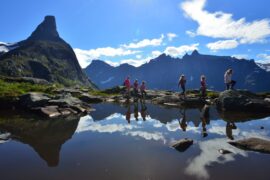
Norway is home to some of the last unspoiled natural wonders in Europe, with scenic landscapes just about everywhere you look. If you’re interested in getting away from it all on a long-distance hike, you’ll be spoiled for choice in Norway. There are incredible walking trails all across the country.
Hiking is a favourite Norwegian past time, which means that most trails are in excellent condition and on longer routes there are often good accommodation options to choose from.
Read on for some of the best long-distance hikes in Norway, including trails that usually take several days to complete with huts to stay in along the way.
The Trollheimen Triangle Route
The Jotunheimen Trail
The Rondane Triangle Route
The Østerdalen Path
The Finnskogleden Trail
The Latitude 63º Trail
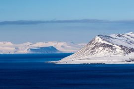
The Lofoten Long Crossing
Nordkalottleden
Hiking in Norway: when to go
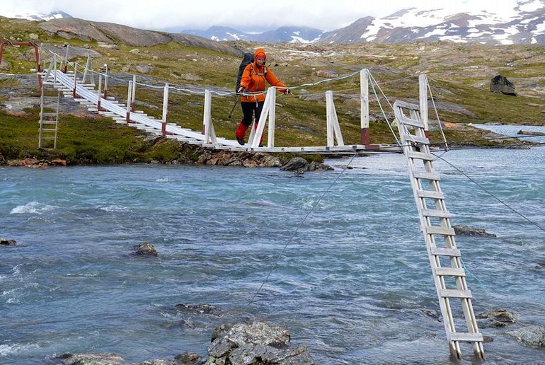
Hiking huts in Norway
Guided hikes in Norway
Trollheimen Triangle Route
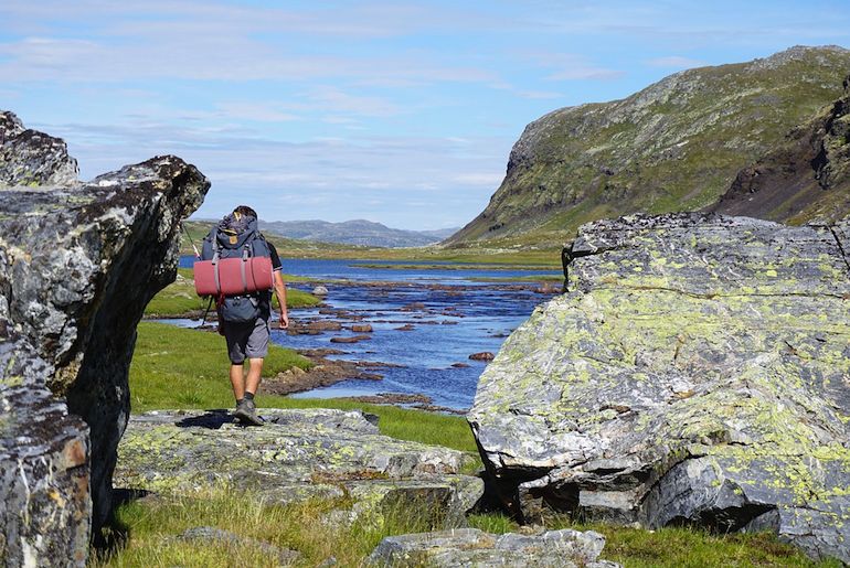
One of Norway’s most popular hiking areas, Trollheimen is a beautiful valley in central Norway that’s surrounded by mountain ranges.
Located in the counties of Møre og Romsdal and Trøndelag, the Trollheimen Triangle is a route that connects three mountain lodges – Gjevilvasshytta, Trollheimshytta and Jøldalshytta.
Each side of the triangle takes around 8 or 9 hours to hike and the path is considered relatively challenging, so bring strong boots.
The route begins at Gjevilvasshytta, from where the trail takes you through pine and birch forests and past crystal blue lakes for 21km (around eight hours’ walking), to Trollheimshytta.
If you’re looking for an extra challenge, you can add in a round trip from Trollheimshytta to Snota, one of Norway’s finest summit hikes.
From Trollheimshytta the triangle continues to Jøldalshytta, which takes around seven hours to complete. The final leg is the path back to Gjevilvasshytta: it’s the most gentle part of the trail – a walk of about 6–7 hours.
Where it is and how to get there
The route begins and ends at Gjevilvasshytta, on the northern shores of Lake Gjevillvatnet.
The nearest town to the trailhead is Oppdal in the southern part of the Trøndelag district, which is about 30 minutes away by car. Public bus #580 runs from Oppdal to the trailhead and takes around 40 minutes.
The train from Oslo to Trondheim stops at Oppdal several times a day, and takes around 5hr–5hr 30min.
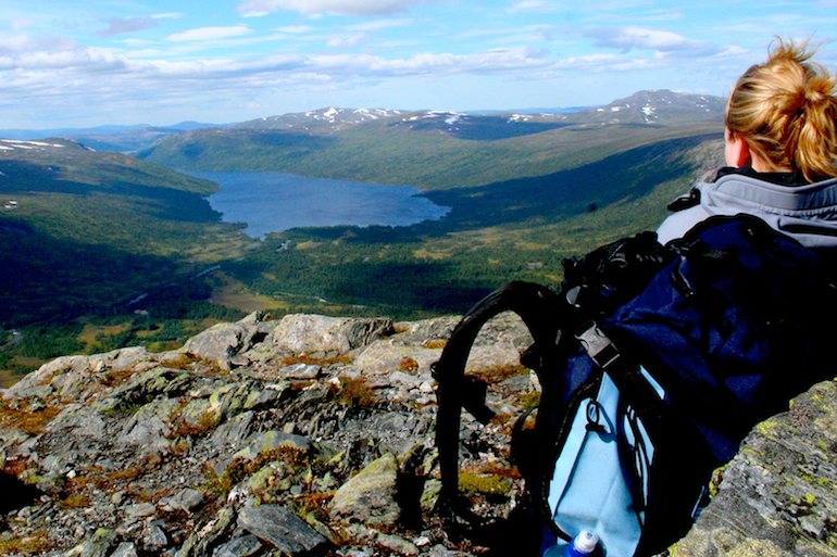
The Jotunheimen Trail
Jotunheimen literally translates as “Home of the Giants” in Norwegian and when you start the hike you’ll soon see why.
This mountainous region of southern Norway covers an area of roughly 3,500 square kilometres and is home to 29 of the country’s highest mountains.
Starting in Gjendesheim, the Jotunheimen Trail takes you across the famous Besseggen Ridge with its breathtaking views over Gjende and Bessvatnet lakes.
This 14km-long hike takes around 7–9 hours, and is a very demanding trail, recommended for experienced hikers only.
Where it is and how to get there
Gjendesheim lies at the eastern end of Lake Gjende, about a four-drive north of Oslo via the E15 and the FV51.
In summer (mid-June to late September), a bus runs from Fagernes skysstasjon to the trailhead at Gjendesheim, taking about 1hr 20min. The bus from Oslo to Fagernes skysstasjon takes just over three hours.
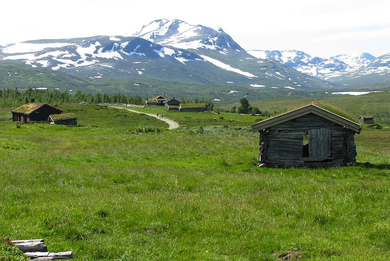
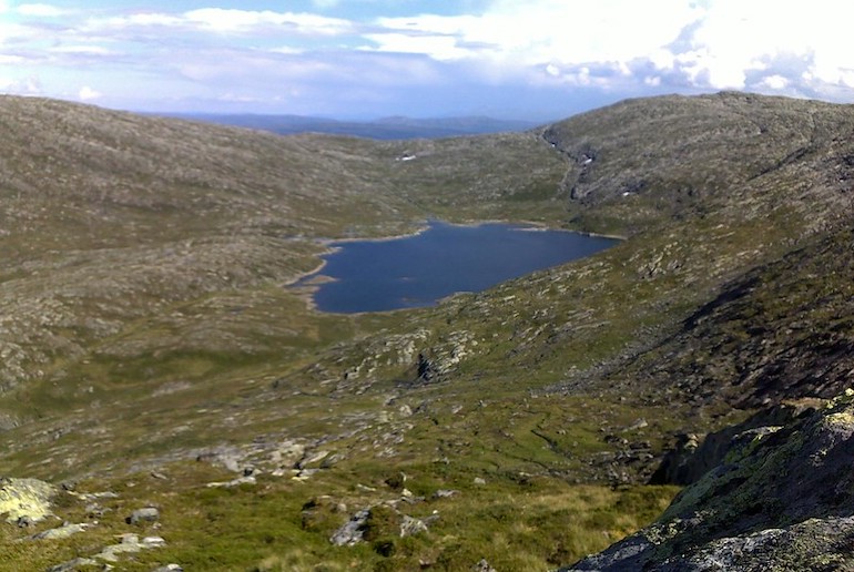
Rondane Triangle Route
Established in 1962, Rondane is Norway’s oldest national park. It covers a vast area of more than 950 square kilometres and boasts ten peaks above 2000 metres.
The park stretches across a unique barren landscape with rocks encrusted with lichen – and look out for wild reindeer along the hiking trail.
The designated hiking route in Rondane is known as the Triangle Route and takes around five days to complete. Each day covers roughly 10km and there’s accommodation at the end of each stage in Rondvassbu, Dørålseter, Bjørnhollia and Spranget.
The hike is graded easy to medium, with the most demanding part of the trail being between Dørålseter and Bjørnhollia where the incline is quite steep.
Where it is and how to get there
Rondane lies in eastern Norway, near the Gudbrandsdalen valley and Folldal. The Triangle route begins at Spranget in the national park. The nearest town is Otta, a 30-minute drive away.
If you’re coming by public transport from Oslo, you can get a bus as far as Vinstra (3hr, 30min), then bus #240 (17 minutes) to to Spranget.
The Østerdalen Path
The Østerdalen Path is an old pilgrimage route dating back to the early Middle Ages.
Stretching over more than 315 kilometres, this peaceful path winds through lush wild valleys, meadows and forests and can take up to eleven days to complete, depending on your levels of fitness and determination.
The majority of the path is fairly easy to walk, as it covers mostly flat, low-lying areas in the valleys, and there are plenty of huts where you can spend the night along the way.
There are two access points for the path, one comes in from the west in a town called Rena, and the other from the east at the border with Sweden. We recommend starting at Rena, as it’s easier to reach by train from Oslo. From Rena, the Østerdalen path continues all the way up to Trondheim.
Where it is and how to get there
The trailhead starts near the town of Rena, a couple of hours’ drive north of Oslo, near the Swedish border and ends in the city of Trondheim on Norway’s west coast.
The train from Oslo to Rena takes about 2hr, 20min, with a change of trains in Hamar.
If you’re just the northern section of the path, or doing the whole lot and want to return to Oslo at the end, the train from Trondheim to Oslo takes around 7 hours.
Finnskogleden Trail
The Finnskogleden Trail is a 13-day hike that takes you from Morokulien through the Finnskogen forest to Søre Osen. As its name implies, this route was used by the Finnish immigrants who settled in the Finnskogen forest in the early 1600s.

Unlike other mountainous hikes in the rest of Norway, the Finnskogleden Trail is relatively flat and heavily forested, which means you may well spot a moose or two. The total distance from start to finish is around 240km.
The trail criss-crosses the border between Norway and Sweden and there is accommodation available at each stage of the trail, including Håvilsrud, Mitandersfors, Lebiko, Øyermoen, Askosberget, Røgden, Løvhaugen, Röjden, Medskogen, Haldammen, Bråten, Håberget and Søre Osen.
However, some of the cabins are unattended without supplies, so you’ll need to bring your own food. The trailhead at Morokulien can be reached from Oslo by train in around two to three hours.
Where it is and how to get there
The trailhead is at Morokulien, a two-hour drive east of Oslo on the Swedish border. From Oslo, you can get a train to Kongsvinger (1hr, 15min), then bus #120 to Morokulien (1hr, 5min).
The Latitude 63º trail
This well-marked trail crosses Norway from Stjørdal on the west coast to Nesjøen lake on the Swedish border.
Known as the official cross-Norway trail, it’s about 120km from start to finish and follows latitude 63º from one side of the country to the other.
The trail takes in the Sylvan mountain massif, pine forests, the beautiful Lake Ramsjøen and several gushing river valleys. It also runs through the Skarvan and Roltdalen National Park.
The terrain can be boggy, as it passes through marshland as well as mountainous regions. Look out for reindeer and their calves if you’re walking the path in May!
It’s recommended that you take about a week to walk the trail, though you can do it in less time if you wish, and there are DNT huts along the way where you can spend the night.
Where it is and how to get there
Located in the Trøndelag region, the trail runs from Stjørdal on the Trondheimfjord across to the Swedish border.
The trailhead at Stjørdal is just 35 minutes drive from Trondheim, or 40 minutes by train.
At the end of the walk, bus #430 runs back to Stjørdal in two hours, 40 minutes.
The Lofoten Long Crossing
The Long Crossing long-distance path runs for 160km through Norway’s stunning Lofoten islands. It starts at the pretty fishing village of Å and ends at Delp in the north.
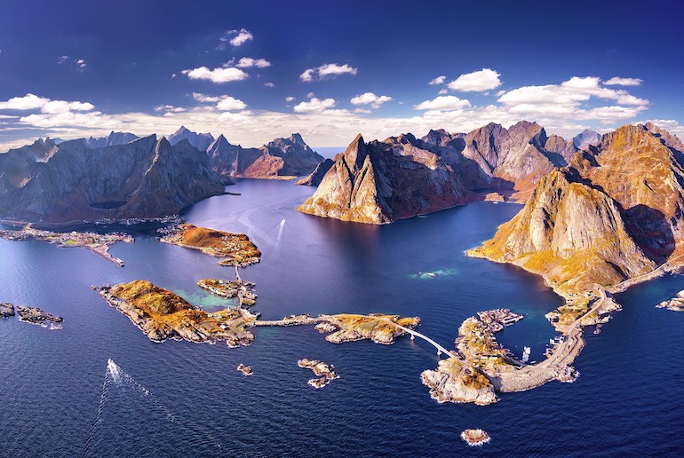
It takes in deserted white sand beaches, lakes, picturesque fishing villages, dramatic ridge walks and mountain peaks.
The path takes about 11 days to walk, with an overall elevation gain of 9200 metres, and is classified moderate to difficult.
Where it is and how to get there
The Lofoten region is a chain of islands that runs along Norway’s west coast, north of Bodø.
The easiest way to get to Å is by ferry from Bodø to Moskenes, 3 miles north of Å. The ferry takes 3hr, 30mins.
Nordkalottleden
Finally, if you’re looking for a really challenging hike in the north of Norway – and have plenty of time – then look no further than Nordkalottleden.
This trek, also known as the Arctic Trail, spans a total length of 800km. It starts and finishes in Norway, but takes you through parts of Sweden and Finland too, zigzagging across the borders a total of 15 times.
The trail starts in Sulitjelma and ends in Kvikkjokk, and it takes around 45 to 50 days to complete. Along this hiking trail, you will witness everything the Norwegian landscape has to offer from dense forest to snowy mountain ranges and tranquil lakes.
Whilst there is plenty of accommodation along the Nordkalottleden route, large parts of this trail are very desolate and careful planning is needed before going.
Where it is and how to get there
Europe’s most northerly long-distance hike, the Arctic Trail starts at Sulitjelma, a 1hr, 20min drive east of Bodø, on Norway’s northwest coast.
There’s a train from Bodø to Fauske on the main E6 road (40 minutes), from where the irregular bus #480 runs to Sulitjelma.
Hiking in Norway: when to go
The best time to go hiking in Norway is between mid-July until late September, when the days are longer and the temperatures higher. During the winter months, snow and ice can also make many hiking trails inaccessible.
In warmer low-lying and coastal areas, the hiking season can sometimes extend from May until October. Check out our post on the best time to visit Norway here.
Hiking huts in Norway
The brilliant part about hiking in Norway is not just the stunning landscapes, but also the excellent infrastructure in place for hikers.
Around the country, you’ll find hundreds of huts and cabins that are run by the Norwegian Trekking Association (DNT). The huts range from staffed lodges to self-service cabins.
Although the self-service cabins are cheaper and come with a gas stove and kitchen equipment for cooking, you’ll have to carry your own food with you.
Guided hikes in Norway
If you like the idea of hiking in Norway, but don’t have the time or the confidence for a full-on multi-day trek, we suggest taking a guided hike in some of Norway’s most dramatic landscapes.
This small group hike from Tromsø gives you a taster of the Arctic wilderness with views over fjords, mountains and islands from the top of the Brosmetinden peak.
This is a challenging hike led by an experienced guide, who will lead the way and point out the flora and fauna en route.
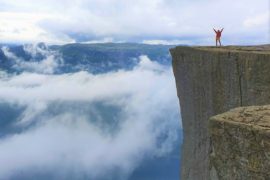
Or how about camping out overnight on the Trolltunga in winter? You’ll hike up this iconic peak, then spend the night in a glamping dome, with a professional guide leading the way and cooking dinner on a campfire.
If you’re based in Bergen and fancy a day’s hiking in the mountains, we suggest this 3–4hr hike up in the mountains surrounding the city. You’ll hike on Mount Hananipa, Mount Bruviknipa, or Mount Arnanipa, depending on the weather conditions.
All offer challenging walking on rugged paths, through unspoilt countryside with spectacular views over the fjord.
For more ideas on guided hikes, read our guide to the best hiking tours in Norway.
Planning a hike? Get insured
Whilst hiking in Norway is generally a safe activity, it’s vital to have adequate insurance, particularly if you’re planning a long-distance trip through the more remote regions.
Shop around to find a policy that suits your requirements and get a few quotes. Make sure, too, that your policy covers any adventure sports or activities that you plan to do. World Nomads provides travel insurance for travelers in over 100 countries. As an affiliate, we receive a fee when you get a quote from World Nomads using this link. We do not represent World Nomads. This is information only and not a recommendation to buy travel insurance.

See also:
Eight great hiking tours in Norway
Norway’s best national parks
The best hiking trails in Sweden


The Nordkalottleden/ruta starts in Sulitjelma and ends in Kautokeino if heading northwards. Kvikkjokk is an alternative trailhead to the south in Sweden. Sulitjelma to Kautokeino is around 750kms, Kvikkjokk to Kautokeino is 800kms.