You don’t have to be a geography geek or a keen cartographer to enjoy a good map. There are some beautifully illustrated maps of Scandinavia out there, from a simply styled Folk Art map to an intricate digitally enhanced map of the region’s waterways.
Nowadays few people use maps for their original purpose, but enjoy them as stunning artworks, or even to decorate cushions and mugs! So if you’ve caught map mania, check out our guide to some of the coolest maps of Scandinavia.
Population density map of Scandinavia
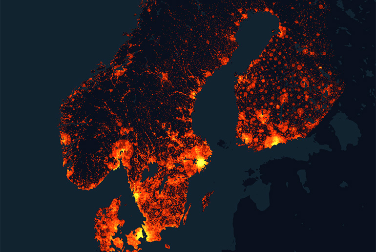
Check out this fascinating population map of Scandinavia, based on a satellite image of lights of the region. The towns and cities have been digitally enhanced to show the areas of highest density in the brightest colours.
And it really brings home the difference in population between southern Scandinavia, in particular high-density Denmark, and the northern reaches of Norway, Sweden and Finland.
Geography geeks and lovers of Geoguessr will have fun guessing the city from the light clusters. Copenhagen, Stockholm, Oslo and Helsinki are easy to spot, but can you identify Bergen, Gothenburg or Trondheim from their lights alone?
Scandinavian waterways map
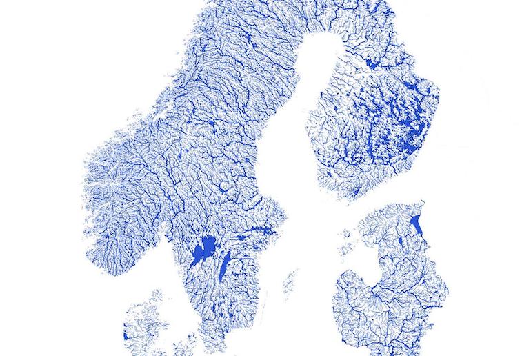
This fun map (available as a print on Etsy) shows Scandinavia’s waterways, lakes, rivers and streams, of which there are many – some 250,000 to be precise – plus the indented coastlines.
The map also includes the Baltic States and comes in nine different colours and backgrounds, though we prefer the original classic blue on a white background! You can either buy the map ready printed or as a digital download and print it at home.
Imaginary map of Scandinavia
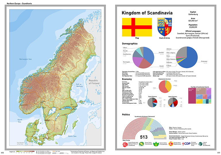
This cool map from 2020 shows what a united Scandinavia might look like. It concentrates on imagining what the three core Scandinavian countries – Norway, Denmark and Sweden – would look like as one single country without borders.
It also shows the potential demographic make-up of a unified Scandinavia with Sweden, unsurprisingly, being the dominant population. The country’s capital is depicted as Gothenburg – a sensible choice given its more central location between the three countries.
Joined together, the three Scandinavian countries would have a population of around 21 million people, be left- and green-leaning and pack a fairly weighty economic punch. Food for thought, maybe?
And if you’re wondering why Finland has been left out of this imaginary unified Scandinavia, check out our quick guide to Scandinavian countries to find out more about which countries are in and which are out of Scandinavia.
Antique map of Scandinavia

There are plenty of old maps of Scandinavia available, but we particularly like this one. It’s beautifully drawn by Swedish cartographer Olaus Magnus and dates from 1539.
It was the first ever map of the Nordic countries to be drawn with accurate labelling, but what we love is the quirky touches, such as the fearsome sea creatures with spiky teeth and hissing serpents. With its sepia tint, it definitely has a vibe of “Here, there be dragons”!
Scandinavian road map
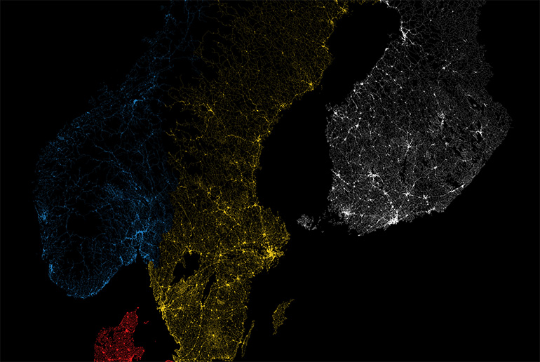
This is an intriguing road map of Scandinavia, though it’s not one that you could use to drive around the region. It’s a satellite image of the region at night showing the lights of the towns, cities and roads.
The roads have been digitally enhanced so that you get a real idea of the infrastructure of each country and which areas are highly populated and which are remote stretches of wilderness.
Each country’s roads have been digitally shaded in a different colour – red for Denmark, blue for Norway, yellow for Sweden and white for Finland – so you can tell where the country borders are by where the roads change colour.
Some roads however just trail off and disappear into the sea, mountains or northern wilderness. This is a fascinating image that Scandinavia map nerds will spend hours poring over.
Illustratated map of Scandinavia
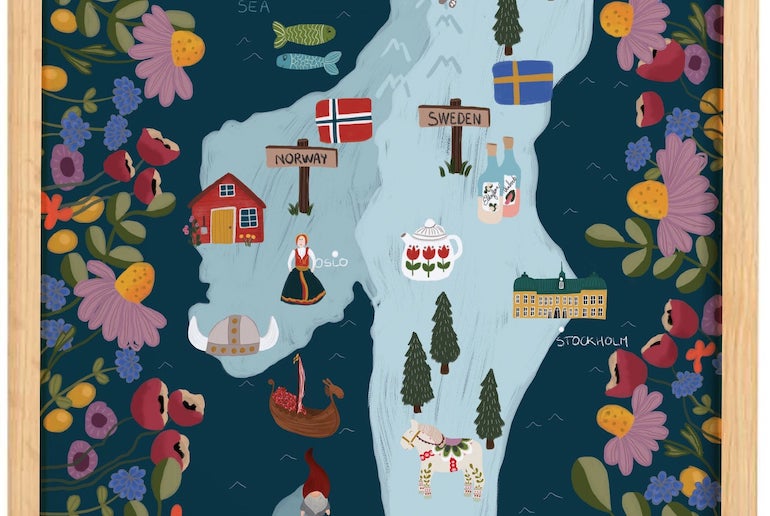
We love this beautifully drawn map of Scandinavia, with its bright primary colours and Scandi Folk Art style. It uses traditional Scandinavian icons such as a Dala horse and a Viking helmet against an icy backdrop, with a border of Scandinavian plants and flowers.
OK, so it’s not detailed enough to be of any use as a map, but it’s a cheery, whimsical image that would brighten up any serious Scandiphile’s wall.
Fantasy map of Scandinavia
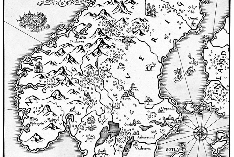
This simple black-and-white pen-and-ink illustration depicts a fictional Scandinavia in the 14th century. Its fantasy dragons, sea creatures and trolls mingle with real-life elk, nomadic medieval hunters and galleons in full sail.
It’s beautifully illustrated and comes printed on cotton in several sizes, though you can also get the same map on cushions, greeting cards, t-shirts, leggings, socks and even a phone case!
Viking map of Scandinavia
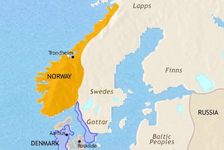
This map gives you a great idea of what Scandinavia would have looked like in 979, in the era of the Vikings. You can see that Sweden, Lapland and Finland merged into each other, while the Danes controlled a large stretch of what is now Sweden’s southwestern coastline.
Check out the Timemap website for a load more maps of the Nordic countries at different times in their history, and to see how Scandinavia’s borders have changed over the years.
Relief map of Scandinavia
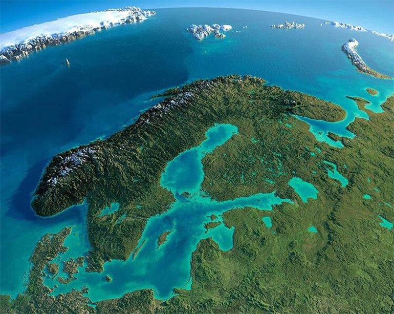
Wow, this relief map of Scandinavia gives a real sense of the topography of Scandinavia, the height of its mountains and the size of its biggest lakes. It’s beautiful to look at, with the land covered in green woodland, the mountains dusted with white snow and the sea a sort of Caribbean blue.
It’s true: there are no towns and man-made features to sully the landscape, but it’s a calming image of what the region would have looked like before deforestation and what parts of the remote northern stretches still look like today.
Modern map of Scandinavia
Thanks to sat navs and Google maps, few people actually use proper paper maps for their original purpose – which is to find which is the best way to get somewhere.
But if you fancy jumping in the car and travelling old-style, the Michelin road map of Scandinavia and Finland – made from good-old fashioned paper – is a safe bet.
Rail map of Scandinavia
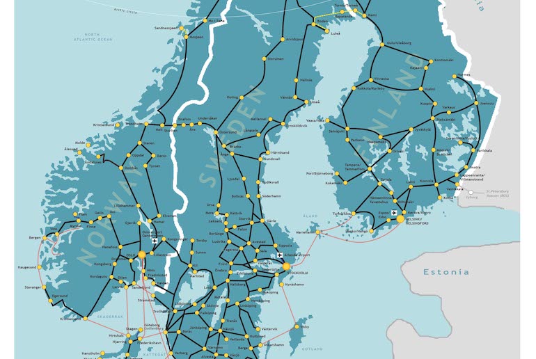
You can’t buy this map, but map geeks and armchair travellers will happily spend hours online on the ACP Rail website checking out rail routes and planning potential train trips. Happy browsing!
See also:
The Scandinavian quiz: which country suits you best?
Solo travel in Scandinavia
The best places to visit in Scandinavia